Altitude: 827m to 1681m. Gain: 1203m. Loss: 1096m . Gradient: 11 deg (Moderate)
Skills: Alpine weather (2/7) - Streams (2/6) Winter - Iceaxe/crampons (4/7)
Note: Described in the reverse direction to your journey
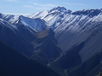
An easy route runs over the saddle between Long Gully and Amphitheatre Creek connecting the Harper River and Avoca. From the confluence of Long Gully and the Harper, head upriver. The valley is tight for the first kilometer, with a couple of scrambles in rocky sections. Beyond that it opens and flats of beech appear and travel becomes easy. 2km from the confluence the first large flat is reached - moss, lichen and low tussock. A further 500m section of beech follows, before the bushedge. Travel is good beyond on solid rocks, low tussock by the creek on a gentle gradient. The final 500m are steeper, and tussock in the valley floor becomes tall, but the north face provides easier travel to the saddle (1hr20 - 2hr40 to saddle). Amphitheathre Creek has 2 forks. I took the northern fork, dropping down into a tussock basin, then sidling at 1400m towards the first beech on the southern face. The creek became steep and was impassable. The last spur before the beech gave access lower valley below the falls. Good rocky river flats and open mossy beech then formed easy travel down to the Avoca. (1.5-3hrs saddle-Avoca)