NZTM2000: 1225747, 5029922
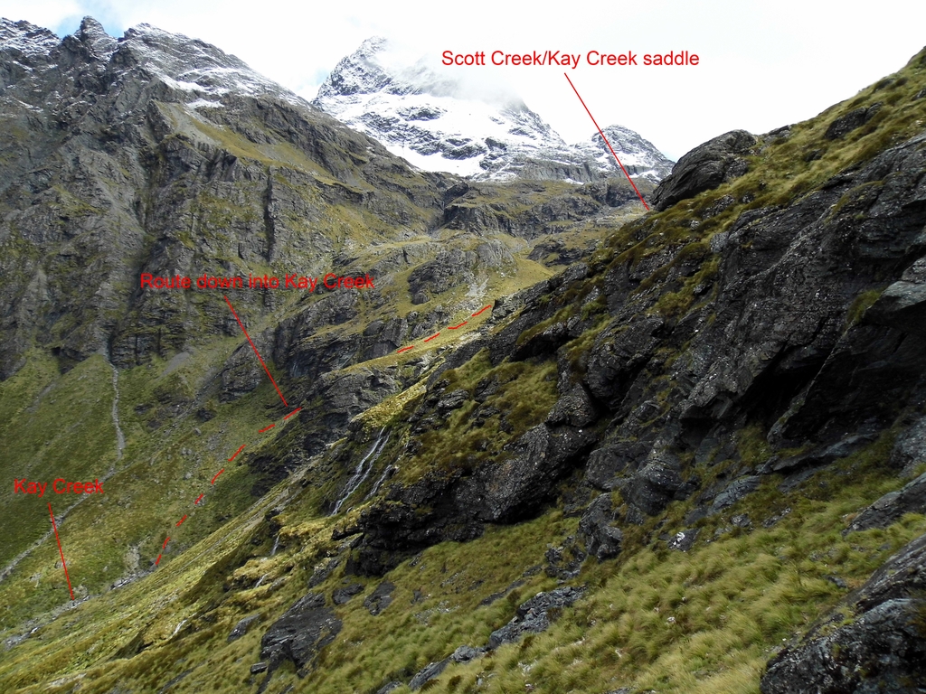
Photo taken while descending into Kay Creek from the east. The usual route into the valley is via a gut on the true right of the main waterfall.
Created by: Yarmoss on 2015-08-15. Last updated: 2015-08-15 09:17:45
Taken on 2015-01-20
Taken on 2015-01-20


My first time on the saddle a couple of years ago I couldn't see a way down either. I didn't realise at the time how big and rolling the Kay Creek/Scott Creek saddle is. I haven't been down the actual route, but I photographed it from the bottom when down at Kay Creek for this trip. It looks very steep and you'd want to be careful in the wet as it seems to be all snow grass. This eastern route down through the bluffs is surprisingly easy. It had snowed the night before and all the rocks above were slick with melting snow (you can see the snow on the tops in this photo), so I cancelled my planned sidle to Sleepy Hollow. The snow grass here was perfectly fine for the descent. It's just not the most direct way down into Kay Creek if you're coming from the saddle!
So Moirs was right ... I came to the conclusion they;d stuffed up their right & left. Coulda sworn there was no way down the true right of that waterfall. Ended up following deer trails down the true left, which was ok, but a little exposed. Wouldn't want to fall.