Altitude: 316m to 343m. Gain: 0m. Loss: 27m . Gradient: 1 deg (Flat)
Skills: - Prolonged rivers (4/6)
Note: Described in the reverse direction to your journey
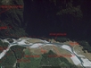
As the map here is quite different to the lay out of the river at Kerin Folks, the route shown is approximate only. See the attached Google Earth image. There are 2 main crossing points at Kerin Folks: -In the jet boat pool.... the large deep pool which is the limit that the jet boats go up the river. There is usually a gravel bar across the pool which is chest deep (about 1.4m) in summer but has almost no current. Obviously the gravel bar might move so the depth might be greater! -Upstream of the rapids. Theres another pool tucked in under the bank on the true right of the river. The water here is about knee-waist deep but has a decent current to it. Obviously the danger here is being swept over and into the rapids between the upper pool and the jet boat pool. The potential is also there to cross above the upper pool and sidle down the true right river bank, which is basically a bluff from opposite the Siberia/Wilkin confluence to the rapids. Lower down Kerin Forks flats is also an option. Dans Flat usually has a gravel braid. You can also flag down a jet boat and ask to be ferried across. This costs about $20 per head. Once across the river, Kerin Forks Hut is on the top of the rise over looking the grassy flats on the true right of the river. An obvious trail leads through the grass to the hut.